
Railway arch at Tyne Dock in 1977
Introduction
The photograph on this page of Railway arch at Tyne Dock in 1977 by Trevor Littlewood as part of the Geograph project.
The Geograph project started in 2005 with the aim of publishing, organising and preserving representative images for every square kilometre of Great Britain, Ireland and the Isle of Man.

There are currently over 7.5m images from over 14,400 individuals and you can help contribute to the project by visiting https://www.geograph.org.uk
Railway arch at Tyne Dock in 1977
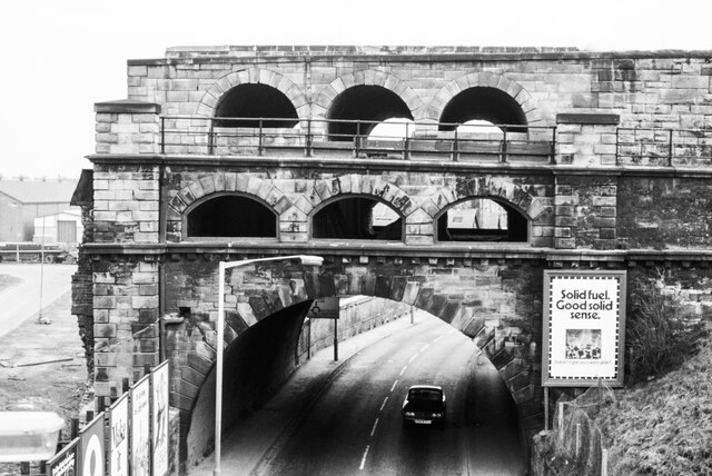
Image: © Trevor Littlewood Taken: 6 Mar 1977
The easternmost of four massive arches that delivered coal by train to staithes that extended into Tyne Dock, off to the left out of the image. The area is entirely changed (in 2021) with all trace of the arches gone and even the huge Tyne Dock filled in and the reclaimed land, redeveloped. Note 1: The accurate locating of the camera position and that of the arch was made possible by the remarkable map resource available on-line from the National Library of Scotland. It's possible to view historical maps at all scales and to overlay them on to up-to-date, aerial views. By using the 'spyglass' feature the historic map is displayed over the modern situation with grid references displayed. Note 2: The image was recorded on Fuji R100 film which, after almost 44 years has developed a colour cast that I haven't been able to correct, even in Lightroom, and so a conversion to black & white has been made.
Images are licensed for reuse under creativecommons.org/licenses/by-sa/2.0
Image Location

Latitude
54.978169
Longitude
-1.446886