West end of St. Paul's Church, Holme Low
Introduction
The photograph on this page of West end of St. Paul's Church, Holme Low by Adrian Taylor as part of the Geograph project.
The Geograph project started in 2005 with the aim of publishing, organising and preserving representative images for every square kilometre of Great Britain, Ireland and the Isle of Man.

There are currently over 7.5m images from over 14,400 individuals and you can help contribute to the project by visiting https://www.geograph.org.uk
West end of St. Paul's Church, Holme Low
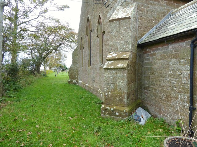
Image: © Adrian Taylor Taken: 18 Oct 2020
The buttressed sandstone west wall of St. Paul's Church, Holme Low. There is an Ordnance Survey cut benchmark visible on the nearest buttress. There was previously an Ordnance Survey 1GL bolt at this location; only the hole remains adjacent to the cut benchmark (photograph Image).
Images are licensed for reuse under creativecommons.org/licenses/by-sa/2.0
Image Location
Latitude
54.867167
Longitude
-3.355696