King Lud's Entrenchments, Leicestershire
Introduction
The photograph on this page of King Lud's Entrenchments, Leicestershire by Kate Jewell as part of the Geograph project.
The Geograph project started in 2005 with the aim of publishing, organising and preserving representative images for every square kilometre of Great Britain, Ireland and the Isle of Man.

There are currently over 7.5m images from over 14,400 individuals and you can help contribute to the project by visiting https://www.geograph.org.uk
King Lud's Entrenchments, Leicestershire
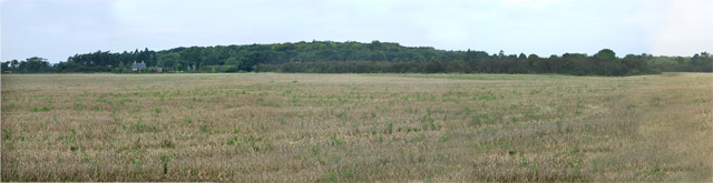
Image: © Kate Jewell Taken: 19 Oct 2005
A vast open field covers most of this square. There is an unfenced road through the middle of the field and to the north this woodland hides King Lud's Entrenchments, possibly part of a tribal boundary of the Bronze Age. See http://www.themodernantiquarian.com/site/2394 Keeper's Cottage can just be seen against the trees to the left: it sits on the boundary with the next square.
Images are licensed for reuse under creativecommons.org/licenses/by-sa/2.0
Image Location


Leaflet Map data © OpenStreetMap
Latitude
52.840924
Longitude
-0.72259