Acton Low Traffic Neighbourhood, Acacia Road closure
Introduction
The photograph on this page of Acton Low Traffic Neighbourhood, Acacia Road closure by David Hawgood as part of the Geograph project.
The Geograph project started in 2005 with the aim of publishing, organising and preserving representative images for every square kilometre of Great Britain, Ireland and the Isle of Man.

There are currently over 7.5m images from over 14,400 individuals and you can help contribute to the project by visiting https://www.geograph.org.uk
Acton Low Traffic Neighbourhood, Acacia Road closure
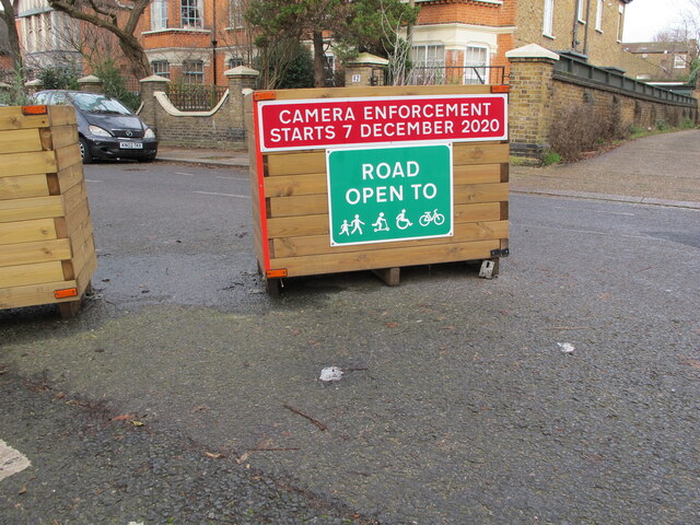
Image: © David Hawgood Taken: 18 Jan 2021
The area behind the photographer is accessible from Churchfield Road, that in front from Horn Lane. The signs here are more friendly than at other closures, the sign show the road open to pedestrians, unpowered scooters, wheel chairs and bicycles. It also shows camera enforcement which will have automatic number plate recognition (ANPR).
Images are licensed for reuse under creativecommons.org/licenses/by-sa/2.0
Image Location
Latitude
51.513155
Longitude
-0.26835