Grange Court (Leominster)
Introduction
The photograph on this page of Grange Court (Leominster) by Fabian Musto as part of the Geograph project.
The Geograph project started in 2005 with the aim of publishing, organising and preserving representative images for every square kilometre of Great Britain, Ireland and the Isle of Man.

There are currently over 7.5m images from over 14,400 individuals and you can help contribute to the project by visiting https://www.geograph.org.uk
Grange Court (Leominster)
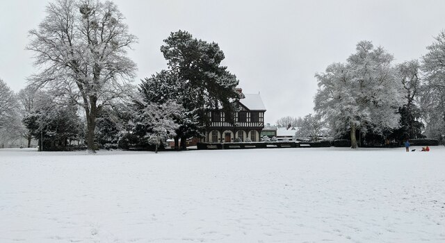
Image: © Fabian Musto Taken: 24 Jan 2021
Built by John Abel in 1633, this building is Leominster's second most popular building. Originally built as the town/market hall on the site of the former Barclays Bank Image, the building was knocked down in 1855 and was rebuilt in the Grange during 1855 to 1859, using the original timbers from the previous building.
Images are licensed for reuse under creativecommons.org/licenses/by-sa/2.0
Image Location


Leaflet Map data © OpenStreetMap
Latitude
52.227711
Longitude
-2.736231