Chalfont Place
Introduction
The photograph on this page of Chalfont Place by Ian Capper as part of the Geograph project.
The Geograph project started in 2005 with the aim of publishing, organising and preserving representative images for every square kilometre of Great Britain, Ireland and the Isle of Man.

There are currently over 7.5m images from over 14,400 individuals and you can help contribute to the project by visiting https://www.geograph.org.uk
Chalfont Place
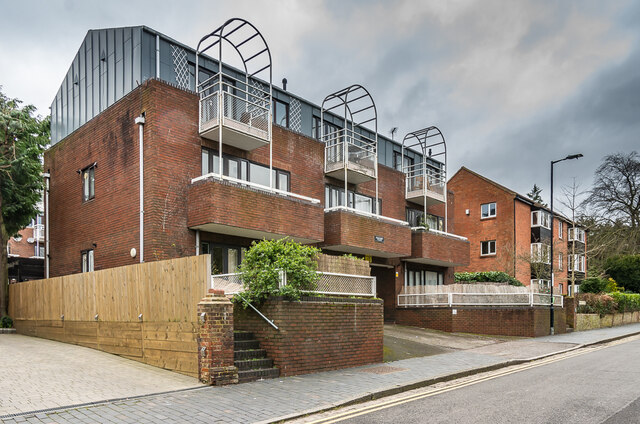
Image: © Ian Capper Taken: 21 Feb 2020
1980s development of 15 apartments on the site of 33 Upper Lattimore Road, itself only built in the c.1960s according to maps. Beyond is Avondale Court, built on the site of what maps suggest was a Victorian house, later (until the 1960s) a nursing home, Brooklands (a name retained in a large neighbouring development in Hatfield Road on the site of what had been local council offices), and then (in the 1970s) a car park (presumably for the council offices).
Images are licensed for reuse under creativecommons.org/licenses/by-sa/2.0
Image Location
Latitude
51.752519
Longitude
-0.331766