Old Boundary Markers on Talbot Court EC3
Introduction
The photograph on this page of Old Boundary Markers on Talbot Court EC3 by M Faherty as part of the Geograph project.
The Geograph project started in 2005 with the aim of publishing, organising and preserving representative images for every square kilometre of Great Britain, Ireland and the Isle of Man.

There are currently over 7.5m images from over 14,400 individuals and you can help contribute to the project by visiting https://www.geograph.org.uk
Old Boundary Markers on Talbot Court EC3
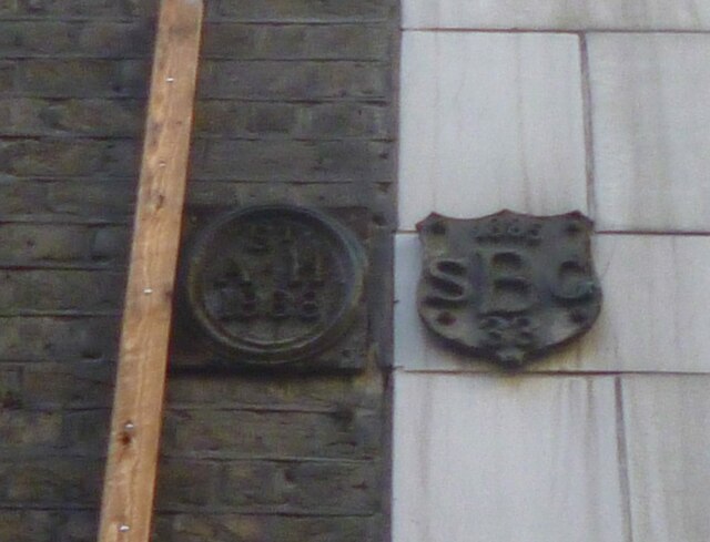
Image: © M Faherty Taken: 16 Feb 2014
Parish Boundary Markers at first floor level on the wall of Nos. 9 and 11 Talbot Court, London EC3, off Eastcheap. CL_SAH02pb on the left and CL_SBG02pb on the right indicate the boundaries of St Andrew Hubbard and St Benet Gracechurch parishes. Milestone Society National IDs: CL_SAH02pb and CL_SBG02pb
Images are licensed for reuse under creativecommons.org/licenses/by-sa/2.0
Image Location
Latitude
51.511032
Longitude
-0.084903