Grain Earth House
Introduction
The photograph on this page of Grain Earth House by Sandy Gerrard as part of the Geograph project.
The Geograph project started in 2005 with the aim of publishing, organising and preserving representative images for every square kilometre of Great Britain, Ireland and the Isle of Man.

There are currently over 7.5m images from over 14,400 individuals and you can help contribute to the project by visiting https://www.geograph.org.uk
Grain Earth House
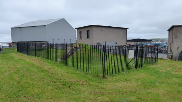
Image: © Sandy Gerrard Taken: 8 Jun 2015
A well preserved souterrain in an industrial estate. Access to the underground chamber is through the door in the fenced compound. https://canmore.org.uk/site/2527/grainbank
Images are licensed for reuse under creativecommons.org/licenses/by-sa/2.0
Image Location
Latitude
58.987953
Longitude
-2.974022