Information board for the Royal Garrison Church of St George, Woolwich
Introduction
The photograph on this page of Information board for the Royal Garrison Church of St George, Woolwich by Marathon as part of the Geograph project.
The Geograph project started in 2005 with the aim of publishing, organising and preserving representative images for every square kilometre of Great Britain, Ireland and the Isle of Man.

There are currently over 7.5m images from over 14,400 individuals and you can help contribute to the project by visiting https://www.geograph.org.uk
Information board for the Royal Garrison Church of St George, Woolwich
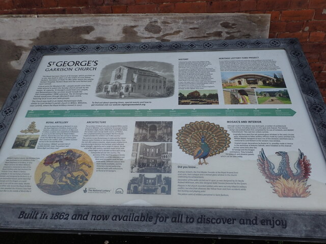
Image: © Marathon Taken: 17 Jan 2021
This is the information board for the Royal Garrison Church of St George, Woolwich as seen at https://www.geograph.org.uk/photo/219470
Images are licensed for reuse under creativecommons.org/licenses/by-sa/2.0
Image Location
Latitude
51.485228
Longitude
0.062731