Aldeburgh houses [14]
Introduction
The photograph on this page of Aldeburgh houses [14] by Michael Dibb as part of the Geograph project.
The Geograph project started in 2005 with the aim of publishing, organising and preserving representative images for every square kilometre of Great Britain, Ireland and the Isle of Man.

There are currently over 7.5m images from over 14,400 individuals and you can help contribute to the project by visiting https://www.geograph.org.uk
Aldeburgh houses [14]
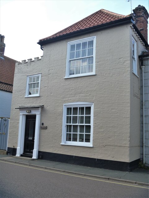
Image: © Michael Dibb Taken: 10 Sep 2020
Number 217 High Street, seen here, and number 219 High Street Image, have been converted into 4 dwellings - Dutch House (217); The Nutshell (217A); Gosfield Cottage (219) and 219A. Built, in brick, in the mid 18th century, altered in the early 19th century and subdivided in the late 20th century. Listed, grade II, with details at: https://historicengland.org.uk/listing/the-list/list-entry/1269740 Aldeburgh is a coastal town, some 20 miles north east of Ipswich and 23 miles south of Lowestoft. Although there are traces of Roman and Saxon occupation, Aldeburgh was a little fishing village until the shifting coastline opened up a sheltered harbour which became a thriving ship building centre. As the River Alde silted up the town’s fortunes waned, and it survived as a fishing village until the 19th Century when it became a fashionable seaside resort. A classical music festival takes place at nearby Snape Maltings each year.
Images are licensed for reuse under creativecommons.org/licenses/by-sa/2.0
Image Location
Latitude
52.149334
Longitude
1.600396