Old Boundary Marker beside Bannerdown Road
Introduction
The photograph on this page of Old Boundary Marker beside Bannerdown Road by R Raynsford as part of the Geograph project.
The Geograph project started in 2005 with the aim of publishing, organising and preserving representative images for every square kilometre of Great Britain, Ireland and the Isle of Man.

There are currently over 7.5m images from over 14,400 individuals and you can help contribute to the project by visiting https://www.geograph.org.uk
Old Boundary Marker beside Bannerdown Road
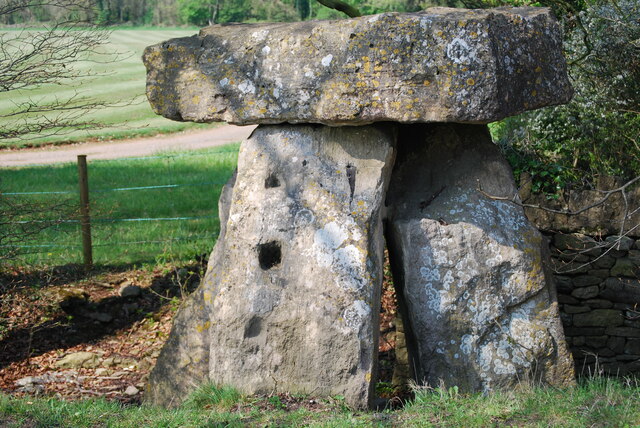
Image: © R Raynsford Taken: 19 Apr 2009
County Boundary Marker called the Three Shire Stones, in the form of a megalith, on the west side of Bannerdown Road, the former Fosse Way. On the boundary of Batheaston, Somerset; Marshfield, Gloucestershire; and Colerne, Wiltshire. Grade II Listed details https://historicengland.org.uk/listing/the-list/list-entry/1156410. See also https://www.geograph.org.uk/photo/3750882 and https://www.geograph.org.uk/photo/3750888. Milestone Society National ID: SO_BAMACO01cb
Images are licensed for reuse under creativecommons.org/licenses/by-sa/2.0
Image Location


Leaflet Map data © OpenStreetMap
Latitude
51.428805
Longitude
-2.294631