Cemetery, Boundary Road, Birkenhead
Introduction
The photograph on this page of Cemetery, Boundary Road, Birkenhead by Stephen Richards as part of the Geograph project.
The Geograph project started in 2005 with the aim of publishing, organising and preserving representative images for every square kilometre of Great Britain, Ireland and the Isle of Man.

There are currently over 7.5m images from over 14,400 individuals and you can help contribute to the project by visiting https://www.geograph.org.uk
Cemetery, Boundary Road, Birkenhead
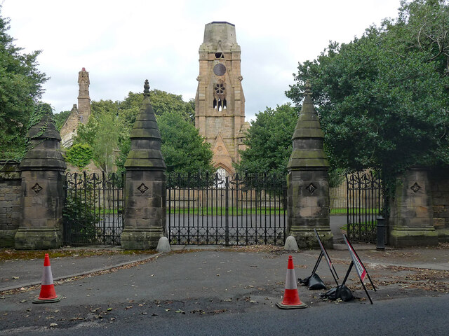
Image: © Stephen Richards Taken: 21 Aug 2014
Flaybrick Hill Cemetery was built in 1862-64 for the Birkenhead Improvement Commissioners. Laid out by Edward Kemp, buildings ("absurdly overwrought in the cemetery manner") by Lucy & Littler. "They have been neglected to ruin, though ruination somehow suits them". Seen here are the main gates and chapels. Grade II listed.
Images are licensed for reuse under creativecommons.org/licenses/by-sa/2.0
Image Location
Latitude
53.396667
Longitude
-3.065612