
Bridge over Frogmire Dike
Introduction
The photograph on this page of Bridge over Frogmire Dike by Matthew Hatton as part of the Geograph project.
The Geograph project started in 2005 with the aim of publishing, organising and preserving representative images for every square kilometre of Great Britain, Ireland and the Isle of Man.

There are currently over 7.5m images from over 14,400 individuals and you can help contribute to the project by visiting https://www.geograph.org.uk
Bridge over Frogmire Dike
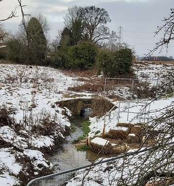
Image: © Matthew Hatton Taken: 10 Jan 2021
Taken from the A59 looking North into Hay-a-Park, one of the old deer parks associated with the lords of Knaresborough Castle in the Middle Ages. The harras fencing is due to the housing development that is going into the fields in the area, whether or not this bridge will survive will be down to the planners, they have already blocked Three Oaks Lane.
Images are licensed for reuse under creativecommons.org/licenses/by-sa/2.0
Image Location

Latitude
54.005853
Longitude
-1.445205