Loftus United Reformed Church
Introduction
The photograph on this page of Loftus United Reformed Church by Humphrey Bolton as part of the Geograph project.
The Geograph project started in 2005 with the aim of publishing, organising and preserving representative images for every square kilometre of Great Britain, Ireland and the Isle of Man.

There are currently over 7.5m images from over 14,400 individuals and you can help contribute to the project by visiting https://www.geograph.org.uk
Loftus United Reformed Church
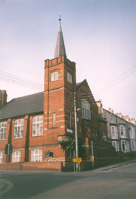
Image: © Humphrey Bolton Taken: Unknown
This church has large windows at the side like a school. The basement was presumably built as a Sunday School. There is what looks like a carved stone outside pulpit on the corner of the tower.
Images are licensed for reuse under creativecommons.org/licenses/by-sa/2.0
Image Location
Latitude
54.553961
Longitude
-0.891378