Yorke Road
Introduction
The photograph on this page of Yorke Road by Ian Capper as part of the Geograph project.
The Geograph project started in 2005 with the aim of publishing, organising and preserving representative images for every square kilometre of Great Britain, Ireland and the Isle of Man.

There are currently over 7.5m images from over 14,400 individuals and you can help contribute to the project by visiting https://www.geograph.org.uk
Yorke Road
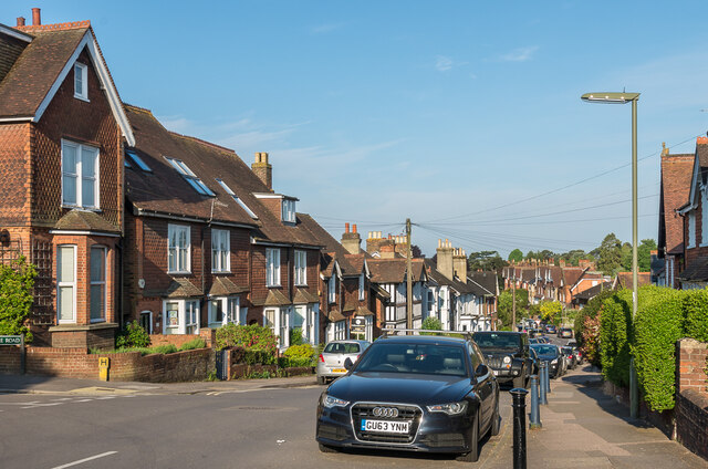
Image: © Ian Capper Taken: 8 May 2020
Late Victorian houses in Yorke Road. The 1896 1:2,500 map marks the road as York Road, but later editions add an "e", which is historically more correct - the Yorkes, Earls of Hardwicke, contributed a total of 5 MPs to Reigate in the late 18th/early 19th Centuries. Another road, Hardwicke Road, comes off Yorke Road - the start of it can just be seen on the far left of this photo.
Images are licensed for reuse under creativecommons.org/licenses/by-sa/2.0
Image Location
Latitude
51.241179
Longitude
-0.210589