An old course of the River Severn on the outskirts of Shrewsbury
Introduction
The photograph on this page of An old course of the River Severn on the outskirts of Shrewsbury by Jeremy Bolwell as part of the Geograph project.
The Geograph project started in 2005 with the aim of publishing, organising and preserving representative images for every square kilometre of Great Britain, Ireland and the Isle of Man.

There are currently over 7.5m images from over 14,400 individuals and you can help contribute to the project by visiting https://www.geograph.org.uk
An old course of the River Severn on the outskirts of Shrewsbury
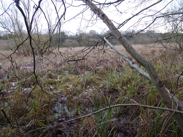
Image: © Jeremy Bolwell Taken: 3 Jan 2021
The Severn changed course at the end of the Last Glaciated period around 12,000 years ago, it is thought. This drastic alteration left its previous course as an empty river bed, or lowland, which remains to this day of course and is now an SSSI and wildlife haven on the edge of housing developments in the suburbs. It looks a fascinating area, of marsh, bulrush beds, wetland grasses and scrub.
Images are licensed for reuse under creativecommons.org/licenses/by-sa/2.0
Image Location
Latitude
52.723547
Longitude
-2.746037