Moulton buildings [4]
Introduction
The photograph on this page of Moulton buildings [4] by Michael Dibb as part of the Geograph project.
The Geograph project started in 2005 with the aim of publishing, organising and preserving representative images for every square kilometre of Great Britain, Ireland and the Isle of Man.

There are currently over 7.5m images from over 14,400 individuals and you can help contribute to the project by visiting https://www.geograph.org.uk
Moulton buildings [4]
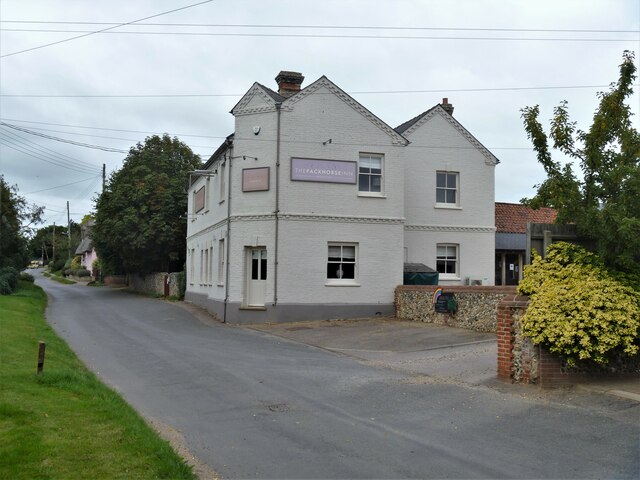
Image: © Michael Dibb Taken: 9 Sep 2020
The Packhorse Inn was known as the Kings Head until 2013. It was built in 1891 to replace an earlier public house destroyed by fire. Constructed in flint with a gault brick front with red brick dressings, now sadly lost under paint. Moulton is a small village some 3 miles east of Newmarket and was settled in Saxon times. The River Kennett flows through the village and a 15th-century packhorse bridge spans the river.
Images are licensed for reuse under creativecommons.org/licenses/by-sa/2.0
Image Location
Latitude
52.252593
Longitude
0.484657