Moulton houses [10]
Introduction
The photograph on this page of Moulton houses [10] by Michael Dibb as part of the Geograph project.
The Geograph project started in 2005 with the aim of publishing, organising and preserving representative images for every square kilometre of Great Britain, Ireland and the Isle of Man.

There are currently over 7.5m images from over 14,400 individuals and you can help contribute to the project by visiting https://www.geograph.org.uk
Moulton houses [10]
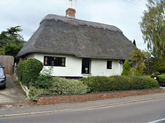
Image: © Michael Dibb Taken: 9 Sep 2020
Number 7 School Road is a 17th century cottage, timber framed and stuccoed with a hipped, thatched roof. Listed, grade II, with details at: https://historicengland.org.uk/listing/the-list/list-entry/1374804 Moulton is a small village some 3 miles east of Newmarket and was settled in Saxon times. The River Kennett flows through the village and a 15th-century packhorse bridge spans the river.
Images are licensed for reuse under creativecommons.org/licenses/by-sa/2.0
Image Location
Latitude
52.253088
Longitude
0.482487