The Peahen
Introduction
The photograph on this page of The Peahen by Ian Capper as part of the Geograph project.
The Geograph project started in 2005 with the aim of publishing, organising and preserving representative images for every square kilometre of Great Britain, Ireland and the Isle of Man.

There are currently over 7.5m images from over 14,400 individuals and you can help contribute to the project by visiting https://www.geograph.org.uk
The Peahen
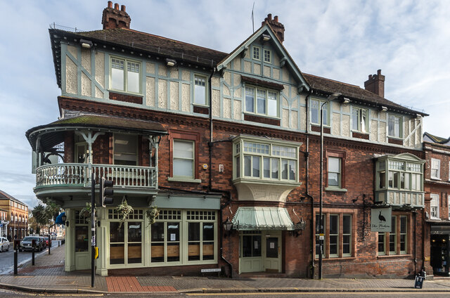
Image: © Ian Capper Taken: 13 Nov 2020
An inn called The Peahen existed at this site in at least the 17th century. However, the current building dates from 1898, when the previous timber framed building was demolished and rebuilt. It is locally listed. It is situated at what was once one of the most important crossroads in the country, being at the meeting point of what were, prior to the building of the M1 Motorway, two of the key roads from London to the north, the A5 and A6 (now renumbered the A5183 and A1081 respectively). The resulting traffic problems led to the junction seeing one of the earliest installations of traffic lights in the country.
Images are licensed for reuse under creativecommons.org/licenses/by-sa/2.0
Image Location
Latitude
51.750771
Longitude
-0.339769