St Mary's Church in Whinburgh
Introduction
The photograph on this page of St Mary's Church in Whinburgh by Evelyn Simak as part of the Geograph project.
The Geograph project started in 2005 with the aim of publishing, organising and preserving representative images for every square kilometre of Great Britain, Ireland and the Isle of Man.

There are currently over 7.5m images from over 14,400 individuals and you can help contribute to the project by visiting https://www.geograph.org.uk
St Mary's Church in Whinburgh
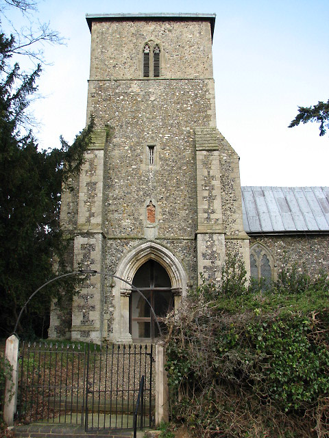
Image: © Evelyn Simak Taken: 29 Jan 2008
The Domesday Survey mentions a church in Whinburgh in 1086. The present church, St Mary's > http://www.geograph.org.uk/photo/671915 stands on the site of this earlier church close to a moated site on which once stood the manor house. The church dates mainly from the 13th century, its tower is situated at the south-west corner rather than at the west end and its bottom stage serves as the south porch. Another peculiarity is the location of the priest door which is in the chancel north wall, rather than in the south wall. An explanation might be found in the pre-Conquest tradition when these doors opened towards the manor house. The church was extensively restored in Victorian times and the chancel > http://www.geograph.org.uk/photo/2050961 was rebuilt in 1886. The baptismal font > http://www.geograph.org.uk/photo/2050985 is original and dates from the 14th century.
Images are licensed for reuse under creativecommons.org/licenses/by-sa/2.0
Image Location
Latitude
52.641103
Longitude
0.963407