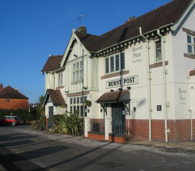
The Burnt Post, Kenpas Highway
Introduction
The photograph on this page of The Burnt Post, Kenpas Highway by E Gammie as part of the Geograph project.
The Geograph project started in 2005 with the aim of publishing, organising and preserving representative images for every square kilometre of Great Britain, Ireland and the Isle of Man.
There are currently over 7.5m images from over 14,400 individuals and you can help contribute to the project by visiting https://www.geograph.org.uk

Image: © E Gammie Taken: 31 Dec 2020
The Burnt Post public house takes its name from a former hamlet shown on old Ordnance Survey maps (1888-1913 six inch) as located at Image The pub is contemporary with the surrounding 1920s/30s housing and shops. The photograph was taken on the first day of Covid-19 Tier 4 restrictions in Coventry which, amongst other things, restricted indoor socialising and required closure of indoor entertainment venues.

