North Street from the railway footbridge
Introduction
The photograph on this page of North Street from the railway footbridge by Lairich Rig as part of the Geograph project.
The Geograph project started in 2005 with the aim of publishing, organising and preserving representative images for every square kilometre of Great Britain, Ireland and the Isle of Man.

There are currently over 7.5m images from over 14,400 individuals and you can help contribute to the project by visiting https://www.geograph.org.uk
North Street from the railway footbridge
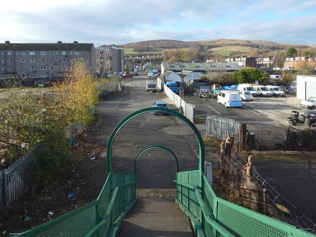
Image: © Lairich Rig Taken: 19 Nov 2020
From the foot of the steps (Image), North Street continues ahead for about 320 metres before meeting Main Street. On the other side of Main Street, Hill Street continues on more or less the same line. Overton Muir (Image) occupies the central part of the background, with Bromley Muir (Image) to its right (NNW). Like Main Street, North Street was in existence when the first-edition OS map was surveyed in 1860. Hill Street, on the other side of Main Street, had not yet been built. North Street was at that time appropriately named, being the northern limit of development in this part of Alexandria. The railway footbridge from which this picture was taken was also present in 1860. The view from there would then have shown gasworks to the right (north) of the road, where there is now a garage. There is still a gas governor there. The eastern side of the footbridge, the side behind the photographer, is shown in Image
Images are licensed for reuse under creativecommons.org/licenses/by-sa/2.0
Image Location
Latitude
55.989646
Longitude
-4.578429