40 and 41 High Street
Introduction
The photograph on this page of 40 and 41 High Street by Ian Capper as part of the Geograph project.
The Geograph project started in 2005 with the aim of publishing, organising and preserving representative images for every square kilometre of Great Britain, Ireland and the Isle of Man.

There are currently over 7.5m images from over 14,400 individuals and you can help contribute to the project by visiting https://www.geograph.org.uk
40 and 41 High Street
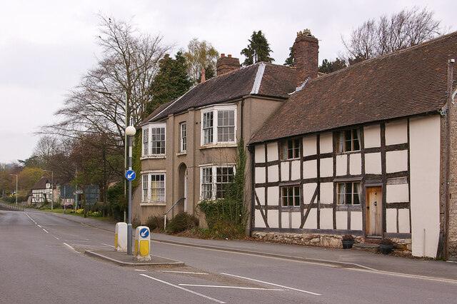
Image: © Ian Capper Taken: 6 Apr 2009
Pair of houses on High Street. No 41 (the nearer of the two) is 16th Century and no 40 is late 18th Century. Both are grade II listed - see www.historicengland.org.uk/listing/the-list/list-entry/1053822 and www.historicengland.org.uk/listing/the-list/list-entry/1367558 respectively.
Images are licensed for reuse under creativecommons.org/licenses/by-sa/2.0
Image Location
Latitude
52.59452
Longitude
-2.561257