Fields above Shaws Lane
Introduction
The photograph on this page of Fields above Shaws Lane by Andy Waddington as part of the Geograph project.
The Geograph project started in 2005 with the aim of publishing, organising and preserving representative images for every square kilometre of Great Britain, Ireland and the Isle of Man.

There are currently over 7.5m images from over 14,400 individuals and you can help contribute to the project by visiting https://www.geograph.org.uk
Fields above Shaws Lane
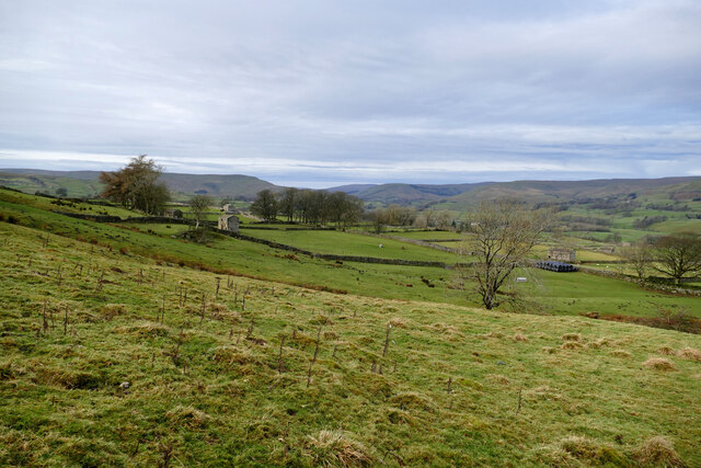
Image: © Andy Waddington Taken: 1 Dec 2020
Shaws Lane, walled both sides, runs along behind the pile of film-wrapped bales towards the small patch of woodland conveying a public footpath towards Gayle. Beyond the trees, Hawes is the major community towards the top of Wensleydale, which continues westwards to the dip in the horizon. The branch valley to the right of centre is Cotterdale and to its right again, the ridge (directly behind the foreground Ash tree) is the popular ascent to Great Shunner Fell.
Images are licensed for reuse under creativecommons.org/licenses/by-sa/2.0
Image Location
Latitude
54.297478
Longitude
-2.174819