Parham village sign (new)
Introduction
The photograph on this page of Parham village sign (new) by Adrian S Pye as part of the Geograph project.
The Geograph project started in 2005 with the aim of publishing, organising and preserving representative images for every square kilometre of Great Britain, Ireland and the Isle of Man.

There are currently over 7.5m images from over 14,400 individuals and you can help contribute to the project by visiting https://www.geograph.org.uk
Parham village sign (new)
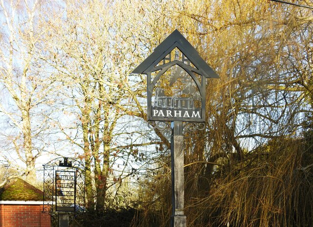
Image: © Adrian S Pye Taken: 20 Dec 2020
The sign incorporates many aspects of the community including the lychgate of the church and the woodsman standing under it representing Parham Wood an ancient wood of about 23 hectares. A B17, Fortress which flew from the USAAF station during WW2 not only represents the sacrifice made by those who served but also the Museum in the old control tower. The church of St. Mary the Virgin is shown with pears hanging from the tree alluding to the name of the parish. The old sign was this https://www.geograph.org.uk/photo/4293716
Images are licensed for reuse under creativecommons.org/licenses/by-sa/2.0
Image Location
Latitude
52.195429
Longitude
1.374035