Old Boundary Marker on Rawtenstall Bridge
Introduction
The photograph on this page of Old Boundary Marker on Rawtenstall Bridge by D Phillips as part of the Geograph project.
The Geograph project started in 2005 with the aim of publishing, organising and preserving representative images for every square kilometre of Great Britain, Ireland and the Isle of Man.

There are currently over 7.5m images from over 14,400 individuals and you can help contribute to the project by visiting https://www.geograph.org.uk
Old Boundary Marker on Rawtenstall Bridge
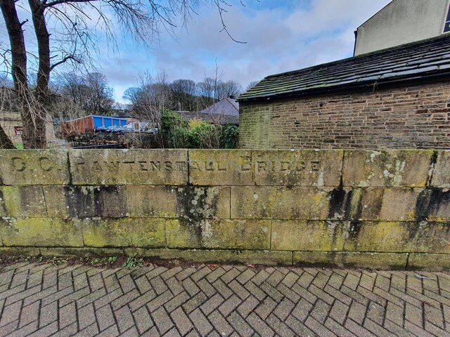
Image: © D Phillips Taken: 18 Dec 2020
Bridge Marker in the eastern parapet of Rawtenstall Bridge, Limy Water, on the northeast side of the junction of the A682 Burnley Road and Newchurch Road, Rawtenstall. Inscribed C C RAWTENSTALL BRIDGE. Milestone Society National ID: LA_RAWTEN08br
Images are licensed for reuse under creativecommons.org/licenses/by-sa/2.0
Image Location
Latitude
53.704654
Longitude
-2.285657