Ixworth houses [35]
Introduction
The photograph on this page of Ixworth houses [35] by Michael Dibb as part of the Geograph project.
The Geograph project started in 2005 with the aim of publishing, organising and preserving representative images for every square kilometre of Great Britain, Ireland and the Isle of Man.

There are currently over 7.5m images from over 14,400 individuals and you can help contribute to the project by visiting https://www.geograph.org.uk
Ixworth houses [35]
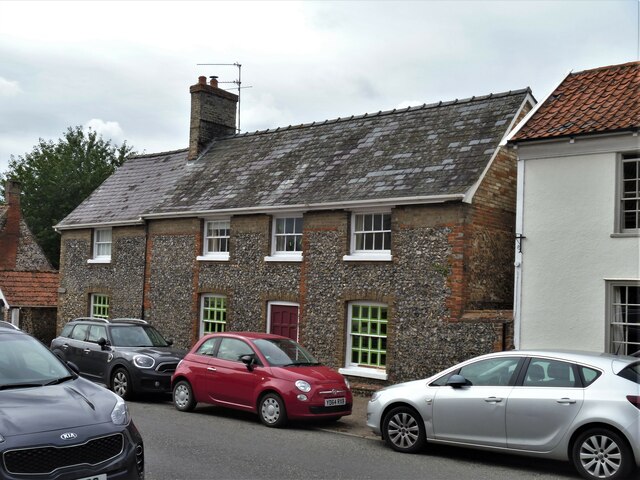
Image: © Michael Dibb Taken: 7 Sep 2020
Originally a row of three houses, now two. Numbers 55 and 57 High Street were built in the early 19th century, raised and altered in the mid 19th century and converted into two in the mid 20th century. Constructed in dark knapped flint with red brick dressings. The heightening is in gault brick, as are the later dressings. Listed, grade II, with details at: https://historicengland.org.uk/listing/the-list/list-entry/1376829 Ixworth is a village some 7 miles north east of Bury St Edmunds. Settled in Roman times and the site of a Roman fort. Later a civilian settlement was established and it became an important junction in the Roman road system of East Anglia. An Augustinian priory was founded in about 1170 and dissolved in 1537. Ixworth is the site of the earliest rural council housing built in England. Now most working residents commute to Bury St Edmunds.
Images are licensed for reuse under creativecommons.org/licenses/by-sa/2.0
Image Location
Latitude
52.300111
Longitude
0.834223