Ixworth houses [6]
Introduction
The photograph on this page of Ixworth houses [6] by Michael Dibb as part of the Geograph project.
The Geograph project started in 2005 with the aim of publishing, organising and preserving representative images for every square kilometre of Great Britain, Ireland and the Isle of Man.

There are currently over 7.5m images from over 14,400 individuals and you can help contribute to the project by visiting https://www.geograph.org.uk
Ixworth houses [6]
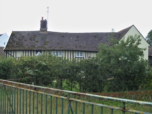
Image: © Michael Dibb Taken: 7 Sep 2020
Bridge House in Bury Road, a former farmhouse is set gable end to the street and is seen here from the bridge over The Black Bourn. Built in 4 bays in the late 16th century, a 5th bay was added in the late 17th century and the cross wing at the right added circa 1950. Timber framed with timbers exposed on the front and stuccoed sides and rear. Listed, grade II, with details at: https://historicengland.org.uk/listing/the-list/list-entry/1031468 Ixworth is a village some 7 miles north east of Bury St Edmunds. Settled in Roman times and the site of a Roman fort. Later a civilian settlement was established and it became an important junction in the Roman road system of East Anglia. An Augustinian priory was founded in about 1170 and dissolved in 1537. Ixworth is the site of the earliest rural council housing built in England. Now most working residents commute to Bury St Edmunds.
Images are licensed for reuse under creativecommons.org/licenses/by-sa/2.0
Image Location
Latitude
52.295565
Longitude
0.828799