Pant Bridge
Introduction
The photograph on this page of Pant Bridge by Sandy Gerrard as part of the Geograph project.
The Geograph project started in 2005 with the aim of publishing, organising and preserving representative images for every square kilometre of Great Britain, Ireland and the Isle of Man.

There are currently over 7.5m images from over 14,400 individuals and you can help contribute to the project by visiting https://www.geograph.org.uk
Pant Bridge
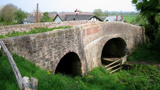
Image: © Sandy Gerrard Taken: 4 May 2006
This bridge was built over a canal and subsequently altered to permit a tramway to pass under the road. The tramway opening is on the left. https://historicengland.org.uk/listing/the-list/list-entry/1391729
Images are licensed for reuse under creativecommons.org/licenses/by-sa/2.0
Image Location
Latitude
52.793764
Longitude
-3.073357