Old Boundary Marker in Lydford on Fosse
Introduction
The photograph on this page of Old Boundary Marker in Lydford on Fosse by S Melligan as part of the Geograph project.
The Geograph project started in 2005 with the aim of publishing, organising and preserving representative images for every square kilometre of Great Britain, Ireland and the Isle of Man.

There are currently over 7.5m images from over 14,400 individuals and you can help contribute to the project by visiting https://www.geograph.org.uk
Old Boundary Marker in Lydford on Fosse
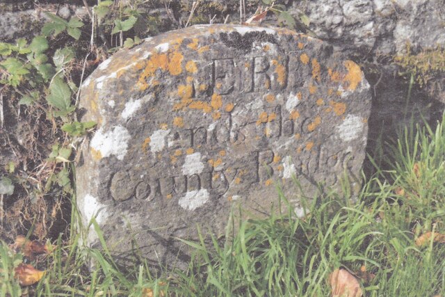
Image: © S Melligan Taken: Unknown
County Bridge Marker on the west side of High Street, south of the bridge on the River Brue. Lydford on Fosse parish. Inscribed HERE / ends the / County Bridge. The stone was erected in 1821 to mark the extent of roadway adjoining the bridge that the County was obliged to maintain. Milestone Society National ID: SO_LYDFFO01br
Images are licensed for reuse under creativecommons.org/licenses/by-sa/2.0
Image Location
Latitude
51.083861
Longitude
-2.62198