S Way Lane, Torquay
Introduction
The photograph on this page of S Way Lane, Torquay by Derek Harper as part of the Geograph project.
The Geograph project started in 2005 with the aim of publishing, organising and preserving representative images for every square kilometre of Great Britain, Ireland and the Isle of Man.

There are currently over 7.5m images from over 14,400 individuals and you can help contribute to the project by visiting https://www.geograph.org.uk
S Way Lane, Torquay
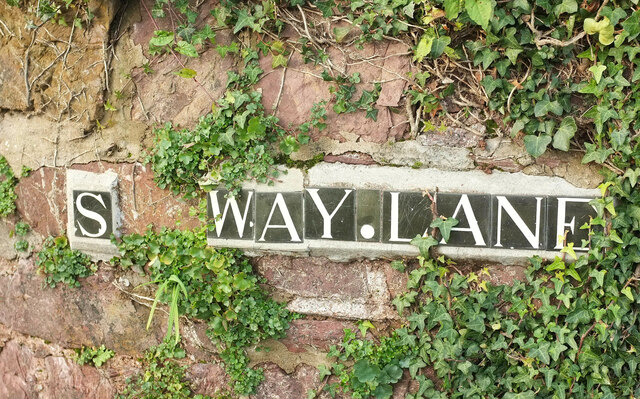
Image: © Derek Harper Taken: 8 Dec 2020
Sad that this tiled road name has been damaged, especially since, unlike most other such tiles across the town which are blue, these are not. Black? Or charcoal grey, perhaps. It should read "Seaway Lane". Also of note is the narrow tile devoted to a full stop, as at https://www.geograph.org.uk/search.php?i=125491301 . Obviously a Chelston thing.
Images are licensed for reuse under creativecommons.org/licenses/by-sa/2.0
Image Location
Latitude
50.45945
Longitude
-3.5447