The Chantry, Sudbury
Introduction
The photograph on this page of The Chantry, Sudbury by Robin Webster as part of the Geograph project.
The Geograph project started in 2005 with the aim of publishing, organising and preserving representative images for every square kilometre of Great Britain, Ireland and the Isle of Man.

There are currently over 7.5m images from over 14,400 individuals and you can help contribute to the project by visiting https://www.geograph.org.uk
The Chantry, Sudbury
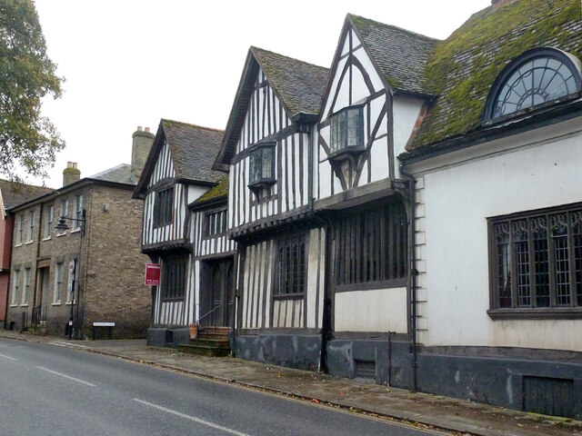
Image: © Robin Webster Taken: 24 Dec 2013
A grade I listed building, 15th century, next door to the similarly aged Salter's Hall to the right.
Images are licensed for reuse under creativecommons.org/licenses/by-sa/2.0
Image Location
Latitude
52.037934
Longitude
0.724857