Southern portal of Netherton Tunnel in 1977
Introduction
The photograph on this page of Southern portal of Netherton Tunnel in 1977 by Trevor Littlewood as part of the Geograph project.
The Geograph project started in 2005 with the aim of publishing, organising and preserving representative images for every square kilometre of Great Britain, Ireland and the Isle of Man.

There are currently over 7.5m images from over 14,400 individuals and you can help contribute to the project by visiting https://www.geograph.org.uk
Southern portal of Netherton Tunnel in 1977
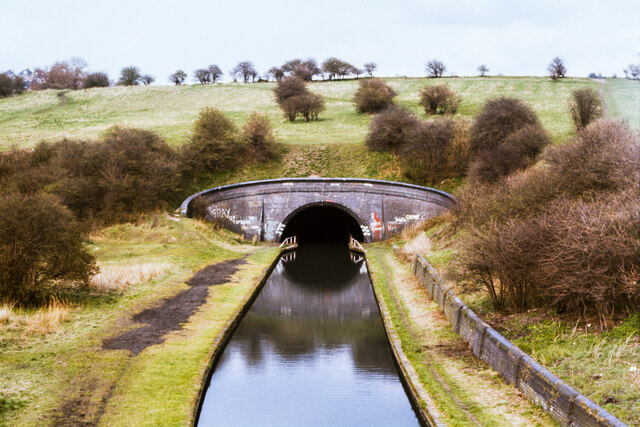
Image: © Trevor Littlewood Taken: 8 Apr 1977
A late development in the Canal Age, the Netherton Tunnel on the Dudley Canal No. 2 line offered a straight line route with tow paths on both sides of the water enabling travel in both directions at the same time.
Images are licensed for reuse under creativecommons.org/licenses/by-sa/2.0
Image Location


Leaflet Map data © OpenStreetMap
Latitude
52.4934
Longitude
-2.069181