View from Califer Hill
Introduction
The photograph on this page of View from Califer Hill by Hazel Milne as part of the Geograph project.
The Geograph project started in 2005 with the aim of publishing, organising and preserving representative images for every square kilometre of Great Britain, Ireland and the Isle of Man.

There are currently over 7.5m images from over 14,400 individuals and you can help contribute to the project by visiting https://www.geograph.org.uk
View from Califer Hill
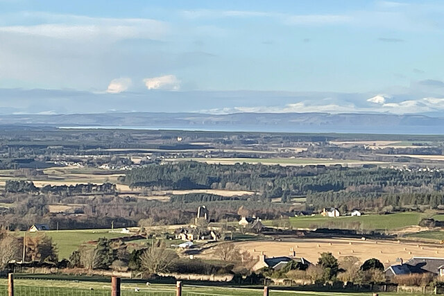
Image: © Hazel Milne Taken: 3 Dec 2020
This was taken by my companion, using her brand-new mobile phone. In the foreground is Upper Califer, and further down and to the left is the ruined tower of Blervie Castle. Almost in line with it, Brodie Castle stands out in the sunlight. Further away is the inner Moray Firth, with the cliffs of the Black Isle on the far side, and snow-capped Ben Wyvis on the skyline. This is part of a wider view taken with the phone in landscape orientation, but it seems to truncate the image when it is sent.
Images are licensed for reuse under creativecommons.org/licenses/by-sa/2.0
Image Location
Latitude
57.594685
Longitude
-3.533921