View from Califer Viewpoint
Introduction
The photograph on this page of View from Califer Viewpoint by Anne Burgess as part of the Geograph project.
The Geograph project started in 2005 with the aim of publishing, organising and preserving representative images for every square kilometre of Great Britain, Ireland and the Isle of Man.

There are currently over 7.5m images from over 14,400 individuals and you can help contribute to the project by visiting https://www.geograph.org.uk
View from Califer Viewpoint
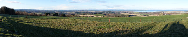
Image: © Anne Burgess Taken: 3 Dec 2020
You can make out the almost landlocked Findhorn Bay on the right, and snow-covered hills in the northern Highlands beyond the Moray Firth.
Images are licensed for reuse under creativecommons.org/licenses/by-sa/2.0
Image Location
Latitude
57.594415
Longitude
-3.53391