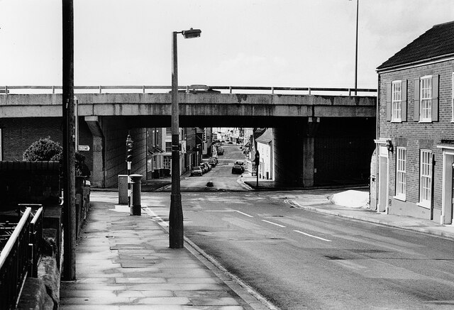
Milford Hill, Salisbury 1986
Introduction
The photograph on this page of Milford Hill, Salisbury 1986 by Mike Searle as part of the Geograph project.
The Geograph project started in 2005 with the aim of publishing, organising and preserving representative images for every square kilometre of Great Britain, Ireland and the Isle of Man.
There are currently over 7.5m images from over 14,400 individuals and you can help contribute to the project by visiting https://www.geograph.org.uk

Image: © Mike Searle Taken: Unknown
The view West towards Milford Street from Milford Hill, the ugly Churchill Way elevated ring road dominating the scene. Built in the 1960s, the flyover runs parallel with Rampart Road whose junction with Milford Hill can be seen in the photo. A number of old buildings were demolished in order to construct it, including at least 5 buildings here on the North side. A view from the same viewpoint of c.1914 show clearly what has been lost: https://media.geograph.org.uk/files/7eabe3a1649ffa2b3ff8c02ebfd5659f/010b_Milford_Hill-original.jpg

