Public Footpath near Palmersville
Introduction
The photograph on this page of Public Footpath near Palmersville by Geoff Holland as part of the Geograph project.
The Geograph project started in 2005 with the aim of publishing, organising and preserving representative images for every square kilometre of Great Britain, Ireland and the Isle of Man.

There are currently over 7.5m images from over 14,400 individuals and you can help contribute to the project by visiting https://www.geograph.org.uk
Public Footpath near Palmersville
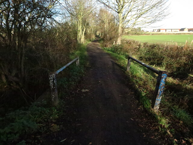
Image: © Geoff Holland Taken: 1 Dec 2020
This public footpath, which links Killingworth Village with Great Lime Road at Palmersville, follows the route of the old Killingworth Waggonway. The waggonway was opened in 1764 and ran from Killingworth Colliery to Willington Quay. The North Tyneside historic network of waggonways had fallen into disrepair over many years but in 2000 North Tyneside Council successfully bid for over £2 million worth of Government funding to transform more than 30 miles of these waggonways into recreational routes for walkers and cyclists. At this point the watercourse known as The Letch flows beneath the footpath https://www.geograph.org.uk/photo/6694420. For a selection of detailed free to download walking routes in the area visit www.northtynesidewalks.co.uk
Images are licensed for reuse under creativecommons.org/licenses/by-sa/2.0
Image Location
Latitude
55.027585
Longitude
-1.554301