High Street, Salisbury 1985 (1)
Introduction
The photograph on this page of High Street, Salisbury 1985 (1) by Mike Searle as part of the Geograph project.
The Geograph project started in 2005 with the aim of publishing, organising and preserving representative images for every square kilometre of Great Britain, Ireland and the Isle of Man.

There are currently over 7.5m images from over 14,400 individuals and you can help contribute to the project by visiting https://www.geograph.org.uk
High Street, Salisbury 1985 (1)
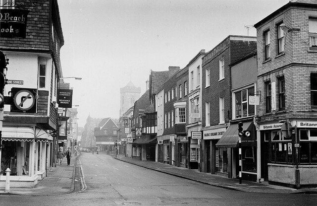
Image: © Mike Searle Taken: Unknown
The view North in 1985 towards the misty outline of St Thomas's church tower. Like many high streets, this area of Salisbury has since been pedestrianised. Compare with a postcard view taken eighty years earlier of c.1905: https://media.geograph.org.uk/files/7eabe3a1649ffa2b3ff8c02ebfd5659f/002b_Salisbury_High_St_North_-original.jpg Image For 56 views of Salisbury High Street through time (c.1900-1960): https://www.flickr.com/photos/mikeofdorset/50675976333/in/album-72157717116714931/
Images are licensed for reuse under creativecommons.org/licenses/by-sa/2.0
Image Location
Latitude
51.067807
Longitude
-1.797436