Former tollhouse
Introduction
The photograph on this page of Former tollhouse by J Malden as part of the Geograph project.
The Geograph project started in 2005 with the aim of publishing, organising and preserving representative images for every square kilometre of Great Britain, Ireland and the Isle of Man.

There are currently over 7.5m images from over 14,400 individuals and you can help contribute to the project by visiting https://www.geograph.org.uk
Former tollhouse
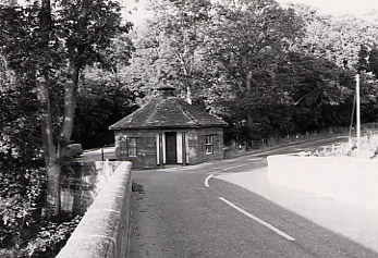
Image: © J Malden Taken: 1 Jun 1982
Surveyed by the Milestone Society. This is a photograph taken in the 1980s of the tollhouse at the east end of the bridge over the River Deveron
Images are licensed for reuse under creativecommons.org/licenses/by-sa/2.0
Image Location
Latitude
57.542636
Longitude
-2.478917