Old Boundary Marker off Mudford Road
Introduction
The photograph on this page of Old Boundary Marker off Mudford Road by S Melligan as part of the Geograph project.
The Geograph project started in 2005 with the aim of publishing, organising and preserving representative images for every square kilometre of Great Britain, Ireland and the Isle of Man.

There are currently over 7.5m images from over 14,400 individuals and you can help contribute to the project by visiting https://www.geograph.org.uk
Old Boundary Marker off Mudford Road
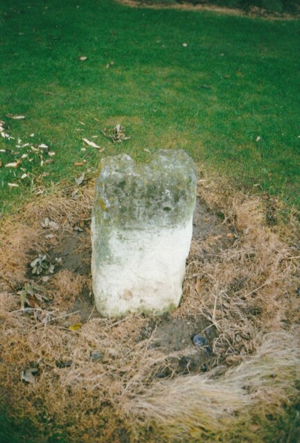
Image: © S Melligan Taken: Unknown
Commemorative Marker in a small public garden on the northeast corner of the crossroads of the A359 Mudford Road, Stone Lane and Combe Street Lane. Mudford parish. The parish boundary between Mudford and Yeovil Without passes to the west and south of the stone. This marks the gathering place of the moot of Stone Hundred, the headmen of places providing one hundred men for the monarch's service. Grade II Listed details https://historicengland.org.uk/listing/the-list/list-entry/1056801. See also https://www.geograph.org.uk/photo/1145505 and https://www.geograph.org.uk/photo/1145506. Milestone Society National ID: SO_MUDF01cm
Images are licensed for reuse under creativecommons.org/licenses/by-sa/2.0
Image Location
Latitude
50.957098
Longitude
-2.633342