Demolition, Prospect Vale
Introduction
The photograph on this page of Demolition, Prospect Vale by Stephen Richards as part of the Geograph project.
The Geograph project started in 2005 with the aim of publishing, organising and preserving representative images for every square kilometre of Great Britain, Ireland and the Isle of Man.

There are currently over 7.5m images from over 14,400 individuals and you can help contribute to the project by visiting https://www.geograph.org.uk
Demolition, Prospect Vale
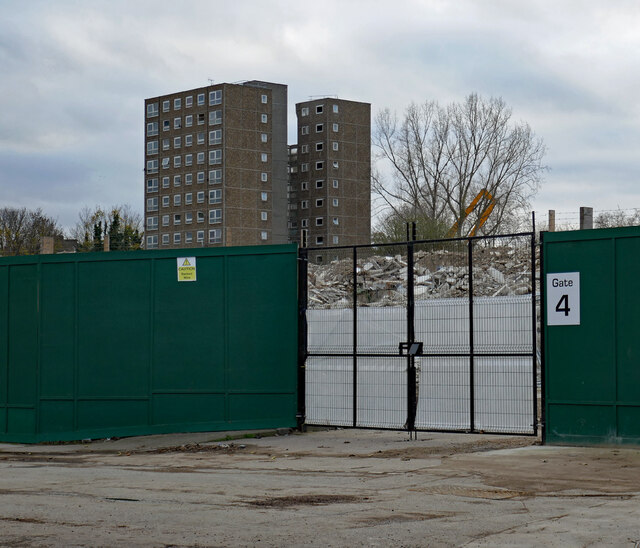
Image: © Stephen Richards Taken: 21 Nov 2020
The remnants of the 1960s Morris Walk Estate. One last tower is on its way out here, and a couple of others stand empty to the right of shot. Greenwich council's Woolwich Estates regeneration project sees them demolishing two other estates so that they can build new ones.
Images are licensed for reuse under creativecommons.org/licenses/by-sa/2.0
Image Location
Latitude
51.490799
Longitude
0.047569