Old Boundary Marker on Denmark Hill
Introduction
The photograph on this page of Old Boundary Marker on Denmark Hill by L Joseph as part of the Geograph project.
The Geograph project started in 2005 with the aim of publishing, organising and preserving representative images for every square kilometre of Great Britain, Ireland and the Isle of Man.

There are currently over 7.5m images from over 14,400 individuals and you can help contribute to the project by visiting https://www.geograph.org.uk
Old Boundary Marker on Denmark Hill
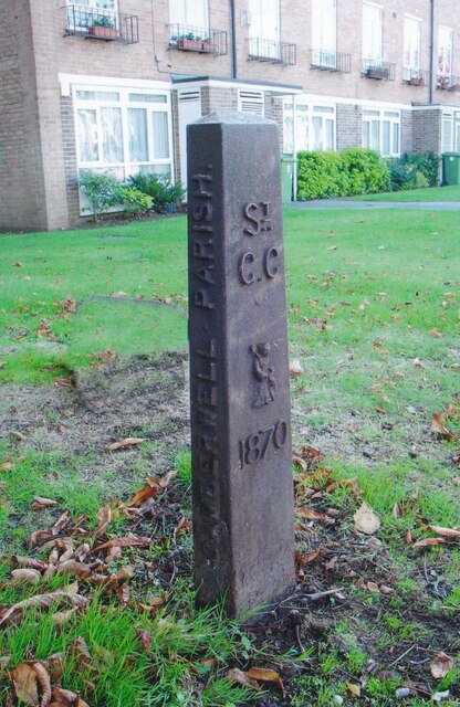
Image: © L Joseph Taken: Unknown
Parish Boundary Marker on grass northwest of Knox House, 169 Denmark Hill SE5 8DU, between the flats and the A215. Formerly on the border of Camberwell and Lambeth St Mary parishes. The border between Southwark and Lambeth is now more towards the centre of Denmark Hill. In raised lettering on the front St / G C / (figure of St Giles) / 1870 and vertically on each side CAMBERWELL PARISH. Milestone Society National ID: SY_SGC06pb
Images are licensed for reuse under creativecommons.org/licenses/by-sa/2.0
Image Location
Latitude
51.46077
Longitude
-0.092464