Housing Development near Rising Sun Country Park
Introduction
The photograph on this page of Housing Development near Rising Sun Country Park by Geoff Holland as part of the Geograph project.
The Geograph project started in 2005 with the aim of publishing, organising and preserving representative images for every square kilometre of Great Britain, Ireland and the Isle of Man.

There are currently over 7.5m images from over 14,400 individuals and you can help contribute to the project by visiting https://www.geograph.org.uk
Housing Development near Rising Sun Country Park
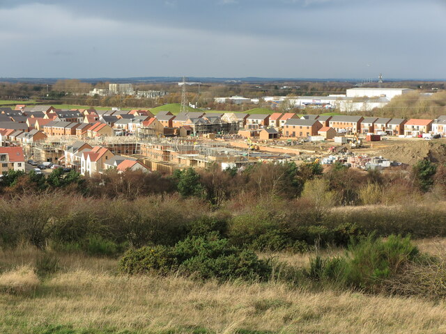
Image: © Geoff Holland Taken: 24 Nov 2020
This photograph was taken from the top of the former spoil heap of the Rising Sun Colliery and shows the extensive housing development between Station Road (A186) and Whitley Road (A191). Sunk in 1906, with production starting in 1908, the colliery was owned by Wallsend & Hebburn Coal Co. Ltd. In 1935 it was described as, "probably the most complete coal preparation plant in the world", providing dry-cleaning, wet-washing, wet and dry screening and blending and mixing and other processes for producing high quality product. The shaft eventually reached a depth of 769 ft (234 m) to exploit the Bensham coal seam, making it one of the deepest in Europe at the time. By 1965 there were 1,722 people employed at the colliery (1,442 working below ground, and 280 working on the surface). The colliery closed in 1969 and the buildings were demolished in the early 1970s. This is now the site of the Rising Sun Country Park which covers an area of 162 hectares, boasts a nature reserve with ponds, woodlands and extensive grasslands, a farm and Countryside Centre, and is criss-crossed by numerous paths and tracks. For a selection of detailed free to download walking routes in the area visit www.northtynesidewalks.co.uk
Images are licensed for reuse under creativecommons.org/licenses/by-sa/2.0
Image Location
Latitude
55.013883
Longitude
-1.542724