Direction Sign ? Signpost in Lower Sabden Fold
Introduction
The photograph on this page of Direction Sign ? Signpost in Lower Sabden Fold by D Phillips as part of the Geograph project.
The Geograph project started in 2005 with the aim of publishing, organising and preserving representative images for every square kilometre of Great Britain, Ireland and the Isle of Man.

There are currently over 7.5m images from over 14,400 individuals and you can help contribute to the project by visiting https://www.geograph.org.uk
Direction Sign ? Signpost in Lower Sabden Fold
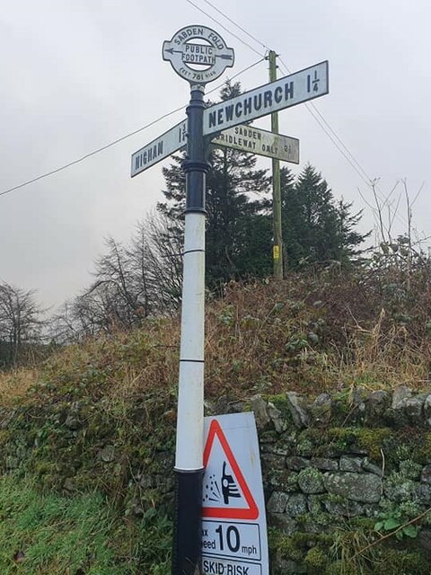
Image: © D Phillips Taken: 21 Nov 2020
Located on the southeast side of the T junction in Lower Sabden Fold, Goldshaw Booth parish. 3 arms and annulus and bar finial. Seen after restoration by Duncan Armstrong. https://www.geograph.org.uk/photo/6684985 shows a photo before restoration Milestone Society National ID: LA_SD8138A
Images are licensed for reuse under creativecommons.org/licenses/by-sa/2.0
Image Location
Latitude
53.841344
Longitude
-2.289658