Direction Sign ? Signpost in Carlton Scroop
Introduction
The photograph on this page of Direction Sign ? Signpost in Carlton Scroop by G Munday as part of the Geograph project.
The Geograph project started in 2005 with the aim of publishing, organising and preserving representative images for every square kilometre of Great Britain, Ireland and the Isle of Man.

There are currently over 7.5m images from over 14,400 individuals and you can help contribute to the project by visiting https://www.geograph.org.uk
Direction Sign ? Signpost in Carlton Scroop
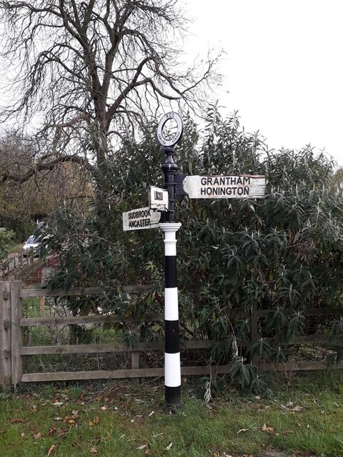
Image: © G Munday Taken: 18 Nov 2020
Located on the south side of the junction of the A607 Main Street and Sudbrook Road in Carlton Scroop parish. 3 arms and annulus finial. Milestone Society National ID: LI_SK9545
Images are licensed for reuse under creativecommons.org/licenses/by-sa/2.0
Image Location
Latitude
52.99703
Longitude
-0.581947