Footpath, Burradon
Introduction
The photograph on this page of Footpath, Burradon by Geoff Holland as part of the Geograph project.
The Geograph project started in 2005 with the aim of publishing, organising and preserving representative images for every square kilometre of Great Britain, Ireland and the Isle of Man.

There are currently over 7.5m images from over 14,400 individuals and you can help contribute to the project by visiting https://www.geograph.org.uk
Footpath, Burradon
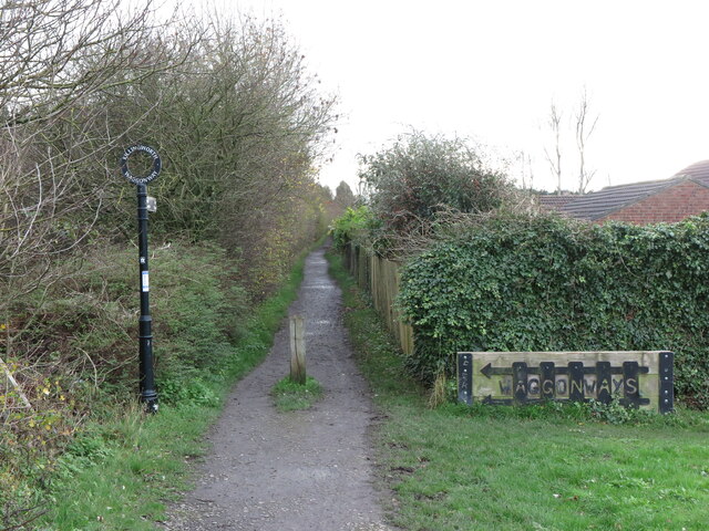
Image: © Geoff Holland Taken: 17 Nov 2020
This footpath, which is not shown on the current Ordnance Survey map of the area as a public footpath but as a traffic-free cycle route, forms part of North Tyneside Council's historic network of waggonways which had fallen into disrepair over many years. However, in 2000 the Council successfully bid for over £2 million worth of Government funding to transform more than 30 miles of these waggonways into recreational routes for walkers and cyclists. When the second edition of the Ordnance Survey Six-Inch map of the area appeared in 1898 a footpath following a similar line to the current one ran from this point, close to where there were two rows of houses known as Burradon Terraces, to Burradon Colliery a short distance to the south. By the time of the publication of the next Ordnance Survey map in 1920 the two rows of houses were named as Annitsford Terrace and an Electric Sub-station stood where this sign now stands. For a selection of detailed free to download walking routes in the area visit www.northtynesidewalks.co.uk
Images are licensed for reuse under creativecommons.org/licenses/by-sa/2.0
Image Location
Latitude
55.049411
Longitude
-1.57644