Sea wall above Throston Scar
Introduction
The photograph on this page of Sea wall above Throston Scar by Andy Waddington as part of the Geograph project.
The Geograph project started in 2005 with the aim of publishing, organising and preserving representative images for every square kilometre of Great Britain, Ireland and the Isle of Man.

There are currently over 7.5m images from over 14,400 individuals and you can help contribute to the project by visiting https://www.geograph.org.uk
Sea wall above Throston Scar
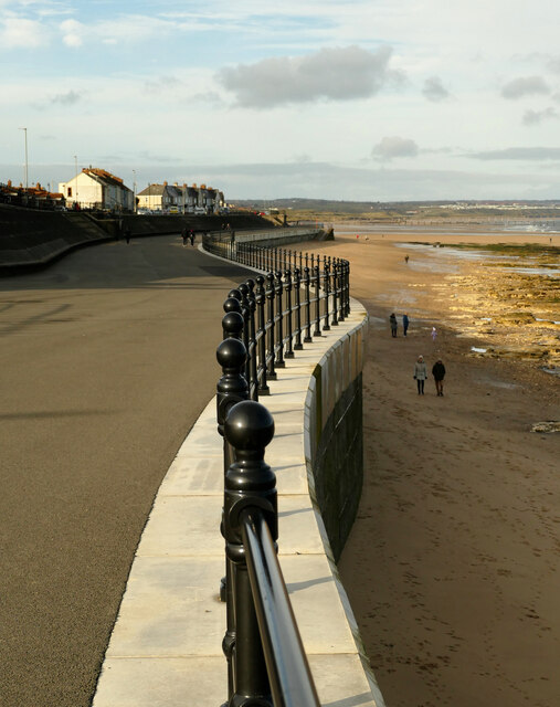
Image: © Andy Waddington Taken: 16 Nov 2020
Throston occupies the narrowest part of Hartlepool Headland and its northern shore is sufficiently sheltered to have accumulated a sandy beach - at least in early winter before the majority of North Sea storms arrive. The £9.6 million sea defence project which ran from 2015 to 2018, has, however, renewed the coping on the sea wall in work which was designed with a lifespan of roughly 100 years, though whether this allows for the rise in sea level caused by climate change is not made clear.
Images are licensed for reuse under creativecommons.org/licenses/by-sa/2.0
Image Location


Leaflet Map data © OpenStreetMap
Latitude
54.702836
Longitude
-1.193036