Far Street, Bradmore
Introduction
The photograph on this page of Far Street, Bradmore by Kate Jewell as part of the Geograph project.
The Geograph project started in 2005 with the aim of publishing, organising and preserving representative images for every square kilometre of Great Britain, Ireland and the Isle of Man.

There are currently over 7.5m images from over 14,400 individuals and you can help contribute to the project by visiting https://www.geograph.org.uk
Far Street, Bradmore
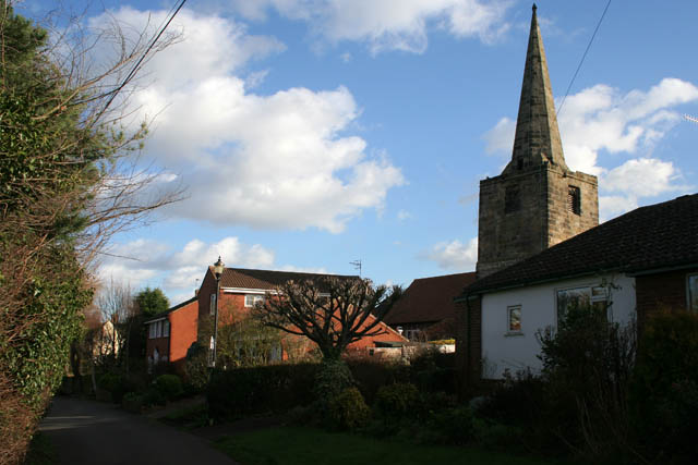
Image: © Kate Jewell Taken: 24 Jan 2008
Looking east along Far Street with the church hemmed in by houses on the right. Bradmore is a small village comprising a 8.2 hectare Conservation Area which includes 19 Listed Buildings or structures (all Grade II). The core of the village has changed little over the last 300 years. A devastating fire in 1705 destroyed 12 houses and numerous barns, stables and workshops in under two hours, the damage estimated at £6000. The village was reconstructed largely by Sir Thomas Parkyns (1662-1741) of Bunny Hall, who designed and built many of the red brick cottages barns and farmhouses in existence today. The 13th/14th century tower and spire of the church survived the fire but was never properly rebuilt and by 1881 a Mission Hall had been built adjoining the original tower. By the beginning of the 20th century this brick building was used as a barn. This now forms part of the church and Holy Communion is celebrated once a month at an altar which is situated at the bottom of the tower. The church has never been dedicated to a saint, and was originally built as a chapel of ease within the main parish of the church at Bunny, see Image
Images are licensed for reuse under creativecommons.org/licenses/by-sa/2.0
Image Location
Latitude
52.87493
Longitude
-1.133758