Burradon Tower, Burradon
Introduction
The photograph on this page of Burradon Tower, Burradon by Geoff Holland as part of the Geograph project.
The Geograph project started in 2005 with the aim of publishing, organising and preserving representative images for every square kilometre of Great Britain, Ireland and the Isle of Man.

There are currently over 7.5m images from over 14,400 individuals and you can help contribute to the project by visiting https://www.geograph.org.uk
Burradon Tower, Burradon
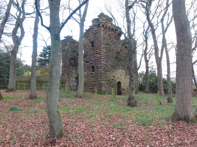
Image: © Geoff Holland Taken: 17 Nov 2020
Burradon Tower is a ruined Pele Tower (defensive tower), built during times of hostilities with Scotland. The Tower is a Grade II listed building and a Scheduled Ancient Monument. The Tower was the focal point of the medieval village of Burradon. The Tower was at one time incorporated into an adjoining farm building. Now it stands alone, enclosed by a stone wall and surrounded by tall trees at Burradon Farm. For a selection of detailed free to download walking routes in the area visit www.northtynesidewalks.co.uk
Images are licensed for reuse under creativecommons.org/licenses/by-sa/2.0
Image Location


Leaflet Map data © OpenStreetMap
Latitude
55.051093
Longitude
-1.569222