Old Boundary Marker on Saltash Road
Introduction
The photograph on this page of Old Boundary Marker on Saltash Road by S Vowden as part of the Geograph project.
The Geograph project started in 2005 with the aim of publishing, organising and preserving representative images for every square kilometre of Great Britain, Ireland and the Isle of Man.

There are currently over 7.5m images from over 14,400 individuals and you can help contribute to the project by visiting https://www.geograph.org.uk
Old Boundary Marker on Saltash Road
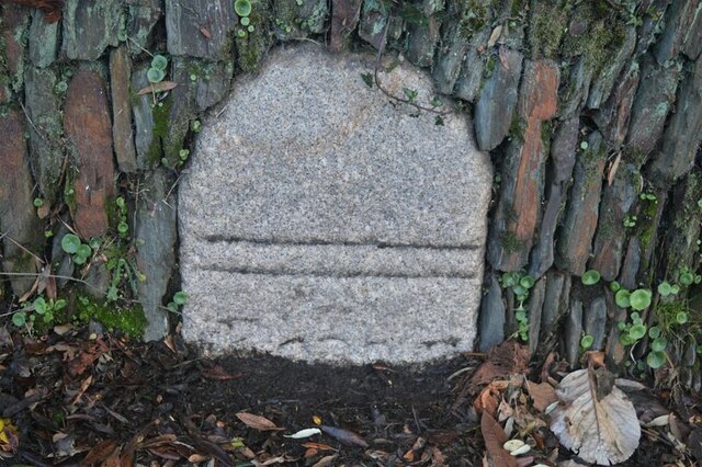
Image: © S Vowden Taken: 16 Nov 2020
Municipal Boundary Marker in a stone wall on the west side of Saltash Road opposite Trelawney Road. Callington parish. Inscribed (two horizontal lines) / BOROUGH (remainder hidden). A Borough Stone to mark the southern bounds of the Borough of Callington in the 17C but now entirely within the parish boundary. Grade II Listed details https://historicengland.org.uk/listing/the-list/list-entry/1140044. Milestone Society National ID: CW_CALL02pb
Images are licensed for reuse under creativecommons.org/licenses/by-sa/2.0
Image Location
Latitude
50.50164
Longitude
-4.313369